
Subterranean Cisterns
Retrospective look at San Francisco's hidden historic fire protection system

For now, my old Hidden Hydrology blog is primarily archival, documenting writings from between 2016 and 2019. However, I do occasionally receive comments and inquiries on posts from back in the day. This past few weeks, readers reached out related to the 2017 post “San Francisco’s Hidden Water Tanks” (Hidden Hydrology, 12.15.17), inquiring about a really cool hidden feature of the urban realm.
The post drew on a great article published at the time by CityLab/Bloomberg, “The Sublime Cisterns of San Francisco" (05.01.17), which explains the presence of brick circles located at numerous intersections around the downtown core of the city, such as the image below.
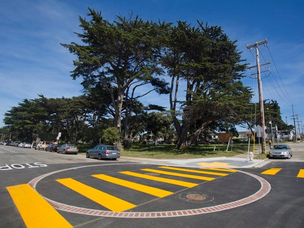
These reference the locations of underground cisterns, dating back to the 1850s, which were state-of-the-art in fire protection in the 19th and early 20th centuries. These cisterns were distributed around the downtown area and filled with water, which supplemented fire brigades and enabled them to pump water for fire-fighting prior to implementing pressurized water systems and fire hydrants. As noted in the Bloomberg article related to the need for new modern fire protection in cities:
“One of the ways officials responded to these blazes was to build cisterns. These subterranean vitrines were designed as a last-resort source of agua for firefighting. San Francisco’s 19th-century cistern system was reinforced with more, larger cisterns after the Earthquake of 1906, whose subsequent firestorm killed roughly 3,000 and left much of the city’s land looking like a blasted moon. To date there are 170 to 200 of the tanks stashed around town.”
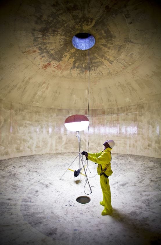
Many of the remaining cisterns are intact below ground, revealing subterranean spaces unknown to those walking and driving above. Many are empty, but some are still used as emergency water sources today.
John Oram, aka the prolific Bay Area blogger Burrito Justice, dug deep into the cisterns as far back as 2011. Around 2016, when the original Bloomberg article was published, he created an interactive map (unfortunately no longer available) of their subterranean locations. The map represented the intersections where the cisterns were located, scaled by the capacity of the cistern below.

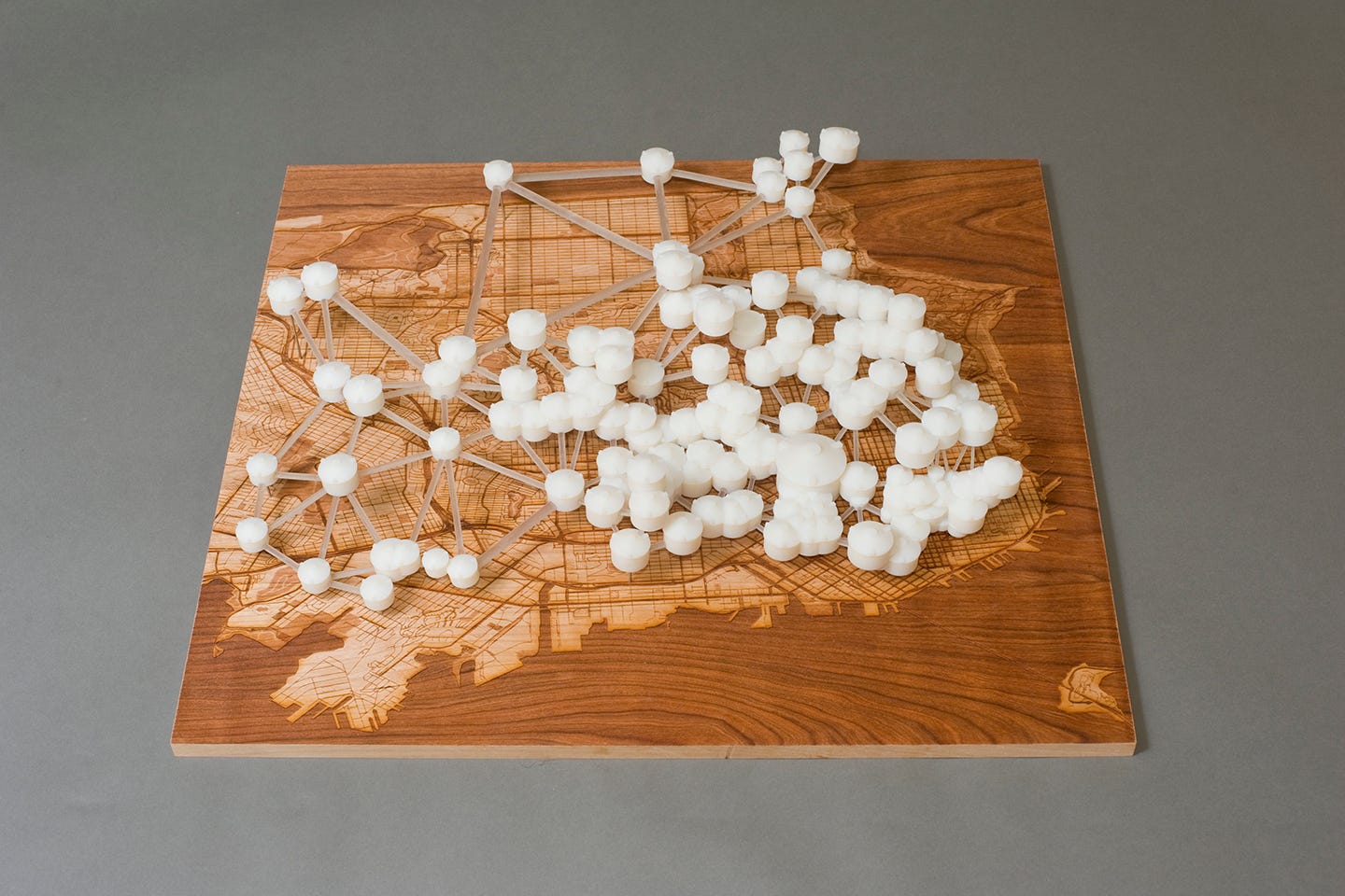
Another resource for these cisterns, which Oram used in his mapping project, was a 2014 project by Scott Kildall. As part of an art project called “Water Works,” Kildall focused on “…a 3D data visualization and mapping of the water infrastructure of San Francisco.” He also created an interactive map (now also unavailable) of the cisterns, and the project generated some interesting maps and art around the locations of key infrastructure, including cisterns, as seen below.
For those interested in a deeper dive from these past sources, I recommend “What’s Underneath Those Brick Circles?” (Burrito Justice, 03.08.13), and “Cistern Mapping Project Reportback.” (Scott Kildall, 01.07.16). Although a seemingly hot topic in the mid-2010s, I only found a few scant more recent references to these cisterns. A good one worth listening to is part of a self-guided tour of these cisterns as part of the Exploratorium installation Buried History - Water Underground along with a link to a downloadable, printable map here.
I would appreciate any input from anyone in the Bay Area with up-to-date information or ongoing projects related to the cisterns.